When Dave and I first started talking about this trip several years ago, we didn’t have charts; instead, I’d stare at Google Maps. I’d trace my finger across the screen, finding possible passages to transit and coves to anchor along the way. This was a time when I still considered Vancouver Island distant shores.
When I zoomed out, I noticed a large archipelago even farther north than Vancouver Island and farther offshore. Haida Gwaii. A world so cloaked in mystery for me that I often dreamt about it. No amount of research could demystify it.
There is something powerful in visiting a place so loved, so cherished, so protected by its inhabitants. And we have never visited a place as revered as Haida Gwaii, especially Gwaii Haanas, the federally and tribally protected southern half of the island chain. I hope I can write about it with the respect it deserves.
All Gwaii Haanas brochures and videos end with the tagline, “When you have reached the edge of your world, ours begins.” The Haida believe that by entering Gwaii Haanas, one enters another world--a place teeming with spirit and soul.
Archeological evidence places the first human inhabitants on the islands at least 12,500 years ago. In this abundant, balanced ecosystem, the Haida developed sophisticated cultures that thrived for millennia.
Then European contact ushered in a Haida dark age. Historians believe there were around 20,000 Haida on Haida Gwaii when Europeans first “discovered” the islands in the 1700s. With the introduction of diseases to which the Haida had no immunity, the population dramatically fell. By the late 1800s, there were fewer than 600 Haida left on Haida Gwaii. Subsequent English-only residential schools and government bans on potlaches divided the Haida from their cultural history and way of life.
Contact also brought a devastating fur trade. The sea otter was nearly hunted to local extinction, causing a natural imbalance from which the islands have still not fully recovered. Later, large-scale clear-cut logging further challenged the balance.
I suppose you could say the same story about countless groups of aboriginal peoples around the world, but this one has a happy ending…well, relatively.
In 1985, logging was at a productive high in Haida Gwaii, often clear-cutting full swaths of islands. As stewards of the land, Haida communities finally took a stand. Many Haida stood arm and arm at the logging roads on Lyell Island and would not budge until they could reach an agreement with the Canadian government. This ultimately led to the creation of the Gwaii Haanas National Park. The Haida Nation and the Canadian government now protect and manage Gwaii Haanas together.
This unprecedented decision marked the end of the Haida dark age.
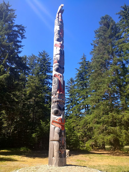
With the land protected, the Haida Nation could thrive once more. Oral histories that survived repression are now written down and taught to the youngest generation. Elders educate children in both English and Haida languages in school. Renewed potlaches, traditional crafts, and ceremonial poles demonstrate a returning renaissance. And with a permit process, orientation training, and watchman program, stewards can ensure travelers to Gwaii Haanas treat the land with respect.
July 22 - 23
On Monday morning, the orientation took about an hour and a half and provided enough time to ask questions. We then spent the rest of the afternoon at the center’s museum and viewed a fantastic display of cultural and natural artifacts. Highly recommended.
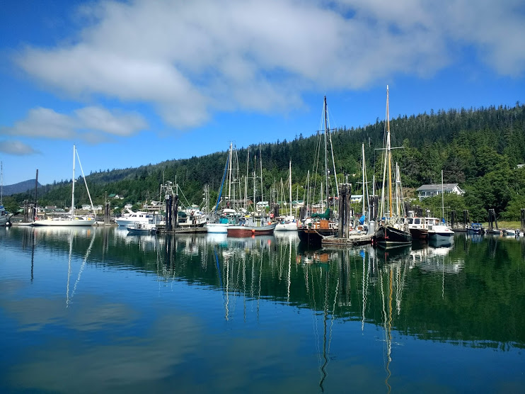 |
| Queen Charlotte Wharf |
 |
| Art in Queen Charlotte City |
 |
| Torch relay handoff for 2010 Vancouver Olympics |
 |
| We finally saw a whale up close! |
 |
| Our Novi |

 |
| Haida Cultural Center |
 |
| Haida Cultural Center |
July 24
The next morning, we headed south. The tide was high enough that we could cross the sandbar at the Skidegate Channel entrance and cut miles off our passage. We sailed into Cumshewa Inlet, aiming for Beattie Anchorage south of Renner Point. We read Beattie was a secure overnight spot in one of our cruising guides. However, when we arrived, logs were tied across. We located one opening and aimed straight for it. As we were about 500 feet away, a small skiff sped out toward us, turned abeam at the last minute, and explained apologetically that we couldn't enter. He had cables and other obstacles strewn across the bay. Good thing he saw us in time! We made a note to contact the cruising guide that suggested the bay so they can update it in their next edition.
Instead, we anchored in Gordon Cove at the end of Gillatt Arm. As soon as we saw it, we wondered if we’d be better off among the cables and logs back at Beattie! 25-30 knots blew through the valleys and over the mountains from the west and rushed haphazardly around in this small cove. Without another option though, we settled in and put out a long scope. Fortunately, our Mantus anchor held us tight all night.
 |
| Cumshewa Inlet |
July 25
We were eager to get to K’uuna Llnagaay, also known as Skedans, our first watchmen site. Historically watchmen lived at the edge of a village and watched for invaders. Today’s watchmen invite visitors, educate them on the history of the sites, and ensure artifacts aren’t desecrated. Once anchored, it's customary to call each site’s watchman on channel 06 and request permission to come ashore. It's also a nice gesture to bring a small gift (e.g. coffee or chocolate from your hometown), though not expected.
At K’uuna Llangaay, Carol Duck (or just Duck) greeted us and passengers from another boat, Island Bay, on the beach. Duck was a fantastic watchman. Her ancestors had lived there, so she felt connected to the land. Every time she missed her family in Skidegate, she would touch the earth or the poles here and feel the presence of her ancestors. Because the same big stones that line the path today were used in keeping the thatched roofs down in storms, she would touch the stones as she passed them because her ancestors “would’ve touched the same stones.” She revered her ancestors’ strength and resilience but mourned for the devastation they must have felt when all but a few died of smallpox. Duck wove warmth, gravity, and humor into her tour.
 |
| Carol Duck, next to a humongous Alder. I've never seen an Alder this big! |
 |
| Crest from the 1890s |
 |
| Crest, now |
 |
| Killer whale mortuary pole, then (When an important person to the community passes, their bones are placed in the bentwood box on the top.) |
 |
| Killer whale mortuary pole, now |
 |
| longhouse pit |
 |
| Sculpin crest, then |
 |
| Sculpin crest, now |
 |
| Life begins anew: spruce grows over cedar house pole |
 |
| Memorial poles were erected when loved ones couldn't access remains (e.g., they were lost at sea). Each ring represented a potlach the honored were a part of in his or her life. The crew of Island Bay show scale. Some poles were buried as deep as10 ft. in the ground to keep them from toppling. |
 |
| Eagle mortuary pole, now nurse log |
Duck's young cousin Tyler was visiting for a few days and played the drum that evening. He sang the song played at the protest encampments of 1985, a song that has become an anthem for the Haida Nation. And like Duck, he had a wry sense of humor:
“Tyler, I noticed you rubbing your drum before you started. Why?” Another visitor asked.
“I need to ask the drum permission before I play,” he responded. “It needs to want to be played. I rub it to awaken its spirit.”
“Wow! Really?”
“Haha. No. The hide gets cold, and I rub it to warm it up.”

Ryan and Sarah, captains of Island Bay, kindly offered to drive us and our kayak back to the boat in their skiff so we wouldn’t have to kayak so far.
Having arrived back at the boat so quickly, we had plenty of time to reach our next destination in the light: Thurston Harbour on Talunkwan Island.
July 26
Thurston Harbour used to be a large logging center. After kayaking to shore, we hiked up the abandoned logging roads and found the forests that were once stripped were now healing. Stumps became nurse logs. The gravel roads were overgrown. Alder grew along the path, making way for later conifers. Further off the path, spruce, cedar, and even a little hemlock were already flourishing.
 |
| Thurston Harbour under a golden sun |
 |
| Abandoned logging hut |
 |
| Alder growing on earlier roads |
 |
| Look carefully. Our new cervine friend is camouflaged. |
 |
| Nurse logs and stumps drawing new life |
July 27:
We didn’t think we’d have time to go to both T’aanuu Llnagaay (Tanu) and Hik’yah GawGa (Windy Bay) watchmen sites in one day—especially since neither of them had secure anchorages to spend the night. We decided to skip Tanu. Windy Bay was the site of the 1985 resistance and victory, and we were eager to visit. It was also our first stop in Gwaii Haanas proper.
The anchorage is tricky. While the inner bay was much calmer, it was also too shallow for our 6’5” draft. Instead, we anchored in the middle of the two bays, hugging the line between the two very different sea states.
Mary lived there in the summers with her young daughter Raven. Mary showed us the Legacy Pole, the pole erected in 2013 to celebrate the 20-year anniversary of cooperative management between the Haida Nation and the Canadian government, and explained the significance of each part. This was the first monumental pole raised in Haida Gwaii in 150 years, a sign of hope for the future. She also showed us the longhouse erected for political organizing in the 1980s. This place had power.
The big seas outside of the bay had power too, and a group of kayakers was marooned there for a few days. But of all the places in the world to be stuck, Windy Bay was not a bad one.
Amy, the guide of the kayak fleet, asked us to join her group on a trail. Raven led the pack, tromping through pinecones and rivers barefoot. The forests here were old growth, healthy. The trail led us to an enormous 900+-year-old spruce. This tree was here at a peak of Haida civilization, during Haida wars, through the devastation of contact, and now peace. And because of the Gwaii Haanas agreement, it will be here until it decays back into the earth.
 |
| The Legacy Pole |
 |
| Six-beam house |
 |
| Dave and a couple of tall kayakers tried to help a scared hummingbird escape the house in the picture above. This approach didn't work. After collaborating as a group, Mary suggested they place a trail of hummingbird feeders and food to the exit. When we returned from the hike, the hummingbird had found its way out. I think there's an analogy to life here somewhere. |
 |
| Windy Bay |
 |
| Harvested cedar |
 |
| Amy shows us more harvested cedar |
 |
| Ethereal old-growth |
 |
| Biiiig spruce |
 |
| Taking a boatline back to camp |
After a wonderful visit, we pulled anchor and headed out to Ramsey Island. From what we could see, it was the closest secure overnight anchorage to tomorrow’s stop: Gandll K’in Gwaay.yaay (also known as Hot Spring Island). We were warned that the mooring buoys aren’t all secure, so we tested one. We tied to it and reversed at full speed. No dragging. We were good.
July 28:
While the buoy was secure, the bay was rolly. The seas were still kicking outside, and they somehow made their way in. In the morning, we untied from the buoy and headed for the temporary anchorage between House Island and Hot Spring Island. If we were going to roll, we might as well do it closer to the hot springs!
A trail through old growth forest led us to the springs, and they were perfect. Watchmen DeeDee and Eric clean them daily, mostly because a local otter bathes in them daily. Oh, and showers! They had showers! And a field of ripe salal.


After we were fully relaxed (and then some), we pulled anchor and headed to Ikeda Cove to spend the night.
July 29 - 30:
Much like Gordon Cove, Ikeda was gusty. Winds surged high in the 30s, and Novi would heel before swinging back against her snubber. But without outside swell, it was comfortable enough. We decided to stay for two nights and slept well both.
We shared the anchorage with one other boat, a beautiful Dana 24 named Ouzel. The owners, Chris and Lisa, stopped by Novi to chat. New to sailing, they had made it all the way to Haida Gwaii from Port Angeles, a testament to their perseverance or the seaworthiness of the boat—or both. We think both.
They pointed out the treasures they found hidden onshore: remains of a mining operation, planks from an old railway, bathing pools, clear creek water.
Eager for more reserve water, we emptied a 5-gallon jug into our tanks and packed it into our kayak with our two Sawyer Minis (water purifiers) and 6 empty water bottles. The tide was high, so we waited for it to drop a foot or two to find the creek flow. This gave us plenty of time to harvest some tidal pickleweed for a poached egg and noodle soup that evening.
We found the above-waterline creek at the end of a marsh. We left our kayak as far upstream as the dropping tide allowed and secured our 5-gallon jug next to it. Then we started up the stream to tackle the laborious process of filtering. We would fill the 12 oz. Sawyer Mini pouches and filter them into a water bottle. We would repeat this process until the bottle was full and then again with each bottle. We would carry the bag of filled bottles back to the kayak and dump them in the water jug. With empty bottles and purifiers, we’d head up the creek to start the process again.
This process took nearly two hours, but the extra 5 gallons provided peace of mind for the dry days to come. We were then free to spend the afternoon exploring the forests and ruins. Ikeda Cove was full of secrets, and we only scratched the surface.
On our paddle back to Novi, we again ran into Chris and Lisa in their rowboat. They suggested we visit the west side of the cove near the bottleneck entrance. A small opening in the woods was marked with a hanging brown rope. Inside were three tombstones with faded Japanese carved into the front. What did they say? Who were buried here? I tell you, this cove is full of mysteries. We will need to tuck these questions away until we got to a place with Internet, perhaps weeks from now.
 |
| Open areas where buildings must have been. Foxglove and moss grow over. |
 |
| Heading up the marsh in high tide |
 |
| Heading down the marsh in low tide; what a difference a couple hours make! |
 |
| old railway |
 |
| Rusted tank turned nurse log |
 |
| Twisty cedar |

 |
| Graves, seemingly out of place |
 |
| Do any Japanese reading friends know what this says? Or is it too faded? |
Update: we still don't know who was buried here, but we learned the founder and owner of the mine was Arichika Ikeda. He died in 1939 and left the mine to his wife, Kaoru Ikeda. She was forced to relinquish the mine when she was taken to the Slocum Internment Camp. After four years in captivity, she died. Neither of them was buried here.
July 31 – August 1:
We wanted the best weather window for heading south to Vancouver Island. This would be our second overnight on De Novo, but our first so far from shore. Currently, the wind was 30-35 knots out there, so we decided to wait out weather in Louscoone Inlet. The cove between the two islands north of Etches Point provided a calm, glasslike anchorage.
Listening to weather reports, we found that winds would lesson to 10-20 knots from the northwest on Wednesday, August 2nd. On Friday, August 4th, they would sweep around and start blowing from the south. We certainly didn’t want to beat to weather out there, so we hoped to reach Vancouver Island by Friday morning. Depending on the conditions and length of gybes, the nearly 200-mile crossing would take either one or two overnights. Wednesday, August 2nd, would be the best day to leave.
We still had one more watchmen site to visit. Near the southern tip of the archipelago, SGang Gwaay was also the most anticipated. With the decision made to leave Wednesday afternoon, Wednesday morning became the time to make a stop there.
We spent Tuesday gearing up for the overnight(s). We precooked and refrigerated meals so we wouldn’t have to handle the complications of cooking underway. We checked all hardware and rigging. Environment Canada forecasts are often wrong, and we wanted to be prepared for rough weather. We also added jerry cans and water jugs to tanks, just in case. We’ve found preparing for a long passage is much like preparing for the apocalypse. We get ready.
I suppose “long passage” is relative. We have friends who have crossed oceans. And we’ve experienced longer passages with others before. But it’s just the two of us now, and we don’t want to leave anything to chance.
Or maybe it's not just the two of us. We have learned so much from others who transited these waters and wrote about them, we’re just a SAT phone text away from loved ones back home, and we have met some of the most wonderful people on this trip.
Speaking of which, we were happy to see Ouzel in the anchorage on Tuesday. Lisa and Chris invited us over for dinner that night. We traded sea stories and exchanged favorite anchoring spots, tucking them away for future trips. At only 24 feet long, Ouzel was perfectly organized for cruising and storage. We could no longer use our boat's small size to justify keeping a messy boat!
 |
| Sailing up Louscoone Inlet |
 |
| Lisa and Chris on SV Ouzel |
 |
| Etches Point Cove |
 |
| Etches Point Cove |
August 2 - 3:
SGang Gwaay: the highlight of any Gwaii Haanas trip. An UNESCO World Heritage Site, sharing this title with the likes of the Great Pyramids and Stonehenge (but without the crowds). A must-see.
As we left Louscoone, we saw another familiar boat, Island Bay. Over the radio, Cliff, the SGang Gwaay watchman, offered to give a simultaneous tour to all three boats: Ouzel, Island Bay, and us. What a wonderful way to spend our last few hours in Gwaii Haanas, among friends.
With Island Bay, we anchored in the north cove between rocky islets. We read in our cruising books the east nook (known as Grays Cove) was too difficult to hook, but Ouzel seemed to do just fine there. Island Bay’s Ryan and Sarah offered to (once again) taxi us to shore in their Zodiac.
We walked a beautiful old-growth trail to meet Cliff, our guide to the site. On the way, we passed through ethereal rock ledges and caves. Remains of the dead (at least those who were without a mortuary pole) were placed in carved bentwood boxes in the ledges. Later, at the beginning of the smallpox era, when the dead far outweighed the living, remains were placed in the caves.
There’s something about this place that inspires imagination. Walking among the poles and the house beams, one can easily visualize the earlier, vibrant village. Those living at SGang Gwaay, the Kunghit Haida, were known as the fiercest warriors of the Haida archipelago. They fought not only Europeans, but other Haida groups. But when Northern Haida fled smallpox-ravished lands further north, the Kunghit Haida gave them sanctuary, and all gathered at SGang Gwaay. When smallpox raged through SGang Gwaay in the 1880s, only bodies remained—hundreds of them; the few survivors fled north to Skidegate. The events of this plague gave the village another name: Wailing Island. Surging waves funneling air through a large hole in rock sounds like a wailing woman, mourning the loss of her home and people.
Several poles and bentwood boxes were sent to museums across Canada to preserve them. For the poles that remain, the watchmen simply let them decay back into the earth as nature intended. We’re told this is the Haida way.
 |
| Rock-sided path |
 |
| One of the several burial caves on the island; out of respect, visitors don't enter or get too close. |
 |
| Fossil |
 |
| Frontal house poles and mortuary poles |
 |
| Spruce splitting a house corner post |
 |
| Remains of a house |
 |
| Our watchman, Cliff, with a mortuary pole |


 |
| Many musket balls have been found embedded in poles and around camp. |
 |
| Corner post with hole for cross beam |
 |
| Cross-beam and corner post, still standing after all these years |
 |
| Fallen beams over house pit |
 |
| Canoe runs, untouched for over a century |

 |

 |
| Cliff with his handmade deerskin drum, nearly completed. He made the mallet from elderberry and leather. He's clearly a hockey fan. :) |
After saying goodbye to friends and Gwaii Haanas, we weighed anchor at around 1:30pm. We set a course for Winter Harbour, Vancouver Island, nearly 200 miles away. Spoiler: we made it, and it only took one overnight. That story, along with the stories of our West Coast adventures will have to wait until next blog post. Thank you to everyone who reads our blog! J
The gravestone has the person's year of death (I'm assuming) on the right and their name on the left! Text is written vertically.
ReplyDeleteThe date is in the Meiji era (began 1868) and it seems like it reads "Meiji 12" which would mean 1880 but there's a few more characters underneath it that could change that. Too faded to tell. 1880 seems early, doesn't it?
I'm not very good at reading names but I'm pretty sure his last name is two or three syllables ending in "ta" or "da" (not Ikeda though, I looked that spelling up).
Thanks Callie! We knew we could count on you! We took pictures of the other tombstones too. We'll show you next weekend?
DeleteHow was the sailing? And sea state on the outer parts?
ReplyDeleteHi Patrick and Natalie! It was good. 8-20 knots most of the time. Nothing bigger. The seas were a little rolly on the east coast, but nothing like you experienced. It sounds like late July was the right time to visit, like you said. When do you return to Seattle? We should have a rendezvous at Shilshole!
DeleteWow, those are great conditions! We may not be going back to Shilshole till March after land travel. If I recall you're heading back by mid Sept - if you're passing by the San Juans soon let us know. We'll be here till Sept 3 then Port Townsend Sept 7-9 for the wooden boat festival.
DeleteWe're actually back now! But we may do a weekend trip to the Sna Juans once things slow down with work. How long will you be there?
DeleteOh, that was fast! Can't wait to hear about the crossing to Van Isle and the trip down the west coast of it.
DeleteWe're hanging near Friday Harbor thru Aug 31 and then going to our cruising club's raftup at Garrison Bay (near Roche) Sep 1-3.